BM Bergmann Marine is partner in various projects.
Here a few of the currently active projects:

Project Description:
Inland waterways represent one of Europe's cleanest transport modes. But, to unlock their full potential, vessels must become smarter, safer, and more automated.
AVIS aims to deliver that leap forward.
We aim to create a navigation ecosystem where:
- Vessels know their position with centimetre-level precision
- River conditions are assessed continuously using Earth Observation intelligence
- Navigation systems predict risks and share trajectories
- Onboard and onshore systems work seamlessly together
- Operators gain confidence in automation through transparency, reliability and trustable safety cases.
Automation is not about removing humans, it's about empowering them with better tools. AVIS prepares the ground for a future where automated inland vessels navigate confidently alongside traditional traffic, under harmonized European standards.
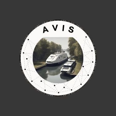
AVIS
Automated Vessels on European Inland WaterwayS
Project Homepage:
Project Duration:
January 2024 to January 2027


Project Partners:

From the Rhine to the Danube and Guadalquivir, AVIS explores how Galileo, EGNOS and Copernicus can elevate safety environmental performance, efficiency and digitalization, all with supporting Europe's Green Deal and NAIADES III ambitions.

Project Description:
VASIRA unites European VDES actors to shape a common architecture for maritime communication services. The project maps existing technical, standardisation, regulatory, and business gaps, aligns a broad stakeholder community, and prepares coordinated contributions to international bodies, supporting interoperable, scalable, and commercially viable VDES networks across Europe and beyond.
The project supports the coordinated development of a unified European VDES ecosystem by identifying the technical, standardisation, regulatory, and business requirements needed for interoperable VDE-SAT and VDE-TER networks. It focuses on consolidating existing developments, identifying requirements, and aligning technical, regulatory and standardisation perspectives among stakeholders.
The activity also targets contributions to international standardisation and regulatory work in bodies such as IALA, ITU, IMO, IEC and RTCM, taking into account interested third-parties' inputs. It considers operational and organisational aspects that influence the deployment and use of interoperable VDES systems.
VASIRA
European VDES Reference Architecture and Related Standardisation, Interoperability and Regulatory Activities
Project Homepage:
https://connectivity.esa.int/archives/projects/vasira
Project Duration:
December 2025 to December 2026
Partner:


Completed Projects

Project Description:
STM is a concept for sharing secure, relevant and timely maritime information among authorized service providers and users, enabled by a common framework and standards for information and access management, and interoperable services. STM relies on four concepts, as follows:
Port Collaborative Decision Making (PortCDM).
The overall goal of PortCDM is to support just-in-time operations within ports and vis-à-vis other actors coordinated by an efficient and collaborative port. It relies on continuous interactions among the maritime actors involved in a port call.
Voyage Management (VM).
VM concerns strategic, tactical and operational decisions about a voyage, such as planned and executed routes of a certain ship and its interaction with nearby ships in a given position.
Flow Management (FM).
FM supports the optimal coordination of multiple ships in congested geographical areas. FM will support both VTS control and ships in optimizing overall traffic flow through areas of dense traffic or those with particular navigational challenges.
Sea System Wide Information Management (SeaSWIM).
SeaSWIM, or a maritime digital infrastructure, provides a framework for the harmonization of data formats and standards for information management and operational services. SeaSWIM includes the use of the newly established Maritime Connectivity Platform for identity and service management.
STM Validation
Sea Traffic Management Validation Project
The project has demonstrated and validated the aforementioned target concepts by deploying large-scale test-beds in both the Baltic and Mediterranean seas involving 311 ships, 9 ports and 6 shore centres. Moreover, STM has demonstrated the benefits of capitalizing on the European Maritime Simulator Network (EMSN), a comprehensive network of ship bridge simulators that has performed specific exercises to assess operational, safety and human factor aspects in a controlled environment.
Project Homepage:
https://www.seatrafficmanagement.info/projects/stm-validation/
Project Duration:
January 2015 to December 2018
Project Partners:


Project Description:
The aim of LEAS is to research an Al-based decision support system for the onshore monitoring and control of mixed traffic. LEAS is geared towards the design, implementation and demonstration of land-based support services for conventional to autonomously navigating and possibly even unmanned ships. This deals with a still completely unknown maritime traffic scenario for which - apart from a few simulation studies - there is no practical experience with the operational requirements and processes. Due to the increasing complexity of traffic situations and the effects ofwrong decisions, the advisory components and modules developed should be based on elements that work with artificial intelligence and implemented in an innovative human machine interface (HMI}. This should explicitly show the human operator the intention of the automated system, i.e. the goals that the system pursues and the means that it uses for this (transparency of artificial intelligence decisions). The acceptance of the developed solutions is of central importance and should be covered by the accompanying research.
LEAS
Landseitige Entscheidungsempfehlung für Verkehrslagen mit hochautomatisierten bzw. autonomen Schiffen
(Land side decision recommendation for traffic situations with highly automated or autonomous ships)
Project Homepage:
Project Duration:
January 2022 to December 2024
Project Partners:


Project Description:
The purpose ofthe PASSport (Operational Platform managing a fleet of semi autonomous drones exploiting GNSS high Accuracy and Authentication to improve Security & Safety in port areas) is to engineer and qualify a solution extending situational awareness based on aerial fixed/ rotary wing and underwater drones to improve safety and security in port areas. The need stems from the directive 2005/65/CE asking to complement surveillance systems for the whole port area, in order to significantly improve security and safety for daily operations implanted in port area. This result also in saving citizen lives ensuring a high and equal level of safety and security for all European ports. Around one thousand European ports fall within the scope of the directive. As a consequence, PASSport responds to the needs expressed by port authorities, harbour master and border control authorities which are active parties in the consortium and will be directly involved in the definition of the proposed solutions. The proposed solution is intended to complement already operational platforms by extending the surveillance perimeter using a fleet of drones to provide innovation and operational support to the recognition, management and analysis of safety and security aspects of daily operations with particular attention to:
- Pollution monitoring (safety)
- Support to e-navigation (safety)
- Critical buildings/ lnfrastructures protection (security)
- Protection against non-cooperative small craft approaching the port areas (security)
- Underwater threats monitoring (security)
The project is expected to activate commercialisation channels based on the novelty represented by the usage of a fleet of semi-automated drones integrating Galileo services (and other sensors) for a safe and efficient guidance, navigation and control (GNC) even in a challenging environment in presence of obstacles - including buildings and other ground assets - and potentially unfavourable weather conditions.
PASSport
(Operational Platform managing a Fleet of semi-autonomous drones exploiting GNSS high Accuracy and Authentication to improve Security & Safety in port areas)
Project Homepage:
Project Duration:
November 2020 to November 2023
Project Partners:

MAREMIS
Maritime traffic modelling and verification for reducing maritime traffic emission based on spatia/-tempora/ big data
Project Description:
The consortium is developing Big Data and machine learning-based models and a demonstrator to measure, track, and validate emissions-related aspects of maritime transport to reduce emissions (exhaust, no ballast water or waste) from ships and improve local air quality. Validation is required because the basis for the project is data from the Automatie ldentification System. These may be partially erroneous or the ship may have disabled its AIS. lt is tobe investigated here whether, on the basis of the trajectories as a string of position signals in relation to the AIS navigation status, ships can no longer be detected in the AIS or whether they have deactivated their AIS.
Project Duration:
August 2021 to July 2023
Project Homepage:
